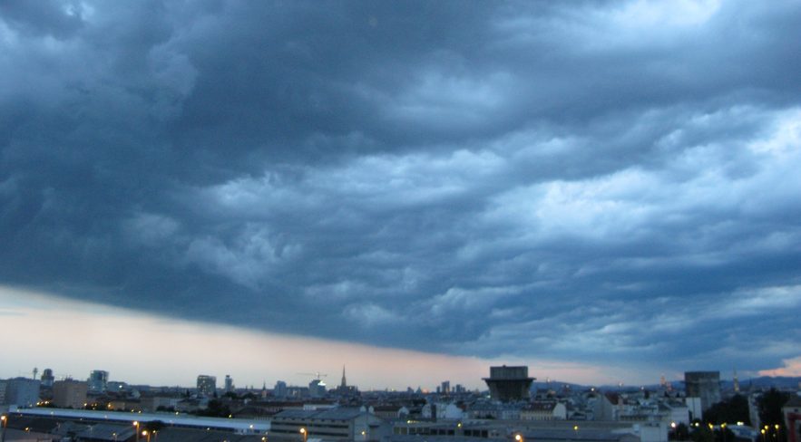
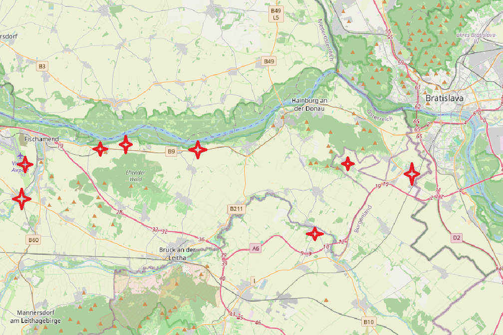
Great model performance that day, already foreshadowing a major storm event over Eastern Austria. Several villages alongside Danube river have been hit on Thursday afternoon, with local flooding, numberous windfall and snapped trees and also saving people’s lives on several occasions. Here’s a video footage on a federal road between Regelsbrunn and Maria Ellend, with a car trapped in the microburst event. In Schwadorf, few kilometres south of Schwechat, even a power pylon has been bended. Some tree damage looks tornadic, e.g. this newspaper photo. But none of the eyewitnesses in the villages did say something about a tornado or landspout („Windhose“).
Media reports have been inconsistent as usual, suggesting different thunderstorms being responsible for severe wind damage. But Kittsee in easternmost Austria has been hit by the same storm event (more photos here). Altogether torn trees and crushed power pylons appear to be the heaviest damage, pointing to an F2/T4 storm event. Private weather stations (published by wunderground) measured peaking wind gusts around 150-180 km/h in Maria Ellend and Kittsee. Position 34 on the Schwechat airport runway registered 71kts. The storm headed for Bratislava, causing serious damage there with intense rain, large hail and violent winds (video) – the footage could indicate a short-lived gustnado, too (04:26 to 04:30).
Preliminary data clearly suggests a straight-line wind event, with some hints at radar images.
Synoptic overview
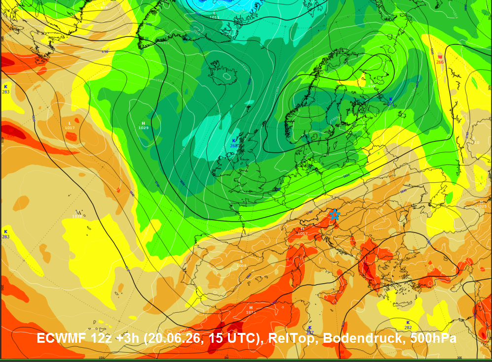
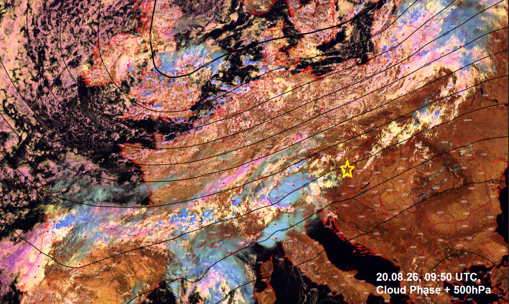
After a long and debilitating summer season with mostly extremly dry air masses and high pressure areas, the large-scale flow transformed into a steamy southwesterly configuration by Thursday, advecting hot and quite unstable air into the alpine area.
Vertical profile:
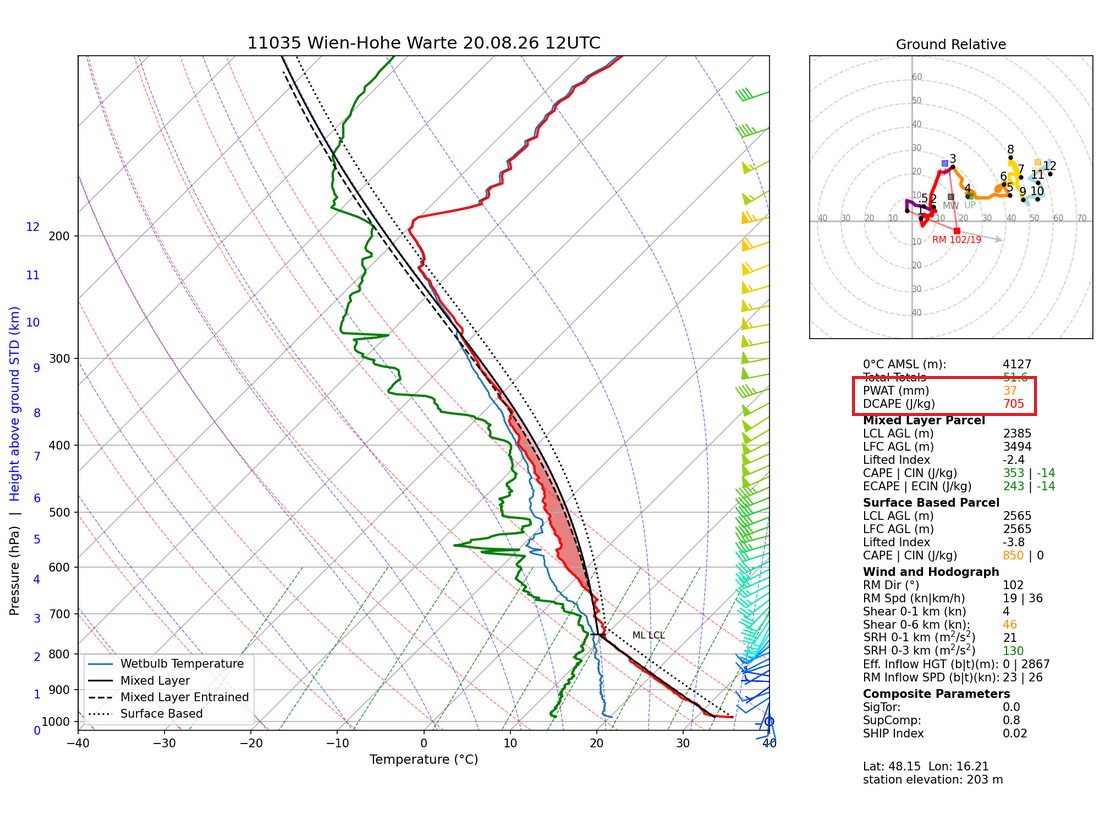
Very dry boundary layer with sufficient amounts of DCAPE and high PWAT, meaning efficient evaporative cooling and downdraft acceleration. Strong mid and upper-level flow. Slightly backing low-level winds which was more pronounced in the eastern part of Lower Austria, creating more 0-3km helicity to add to the thermal buoyancy. Altogether a profile sustaining long-lived updrafts, possible mesocyclones. Due to high cloud base I would have expected more straight-line winds and to a lesser extent tornadic events.
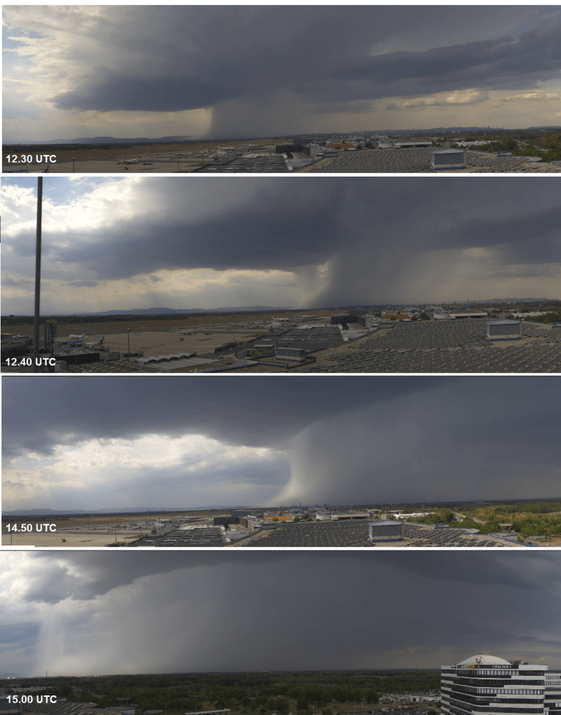
Webcams
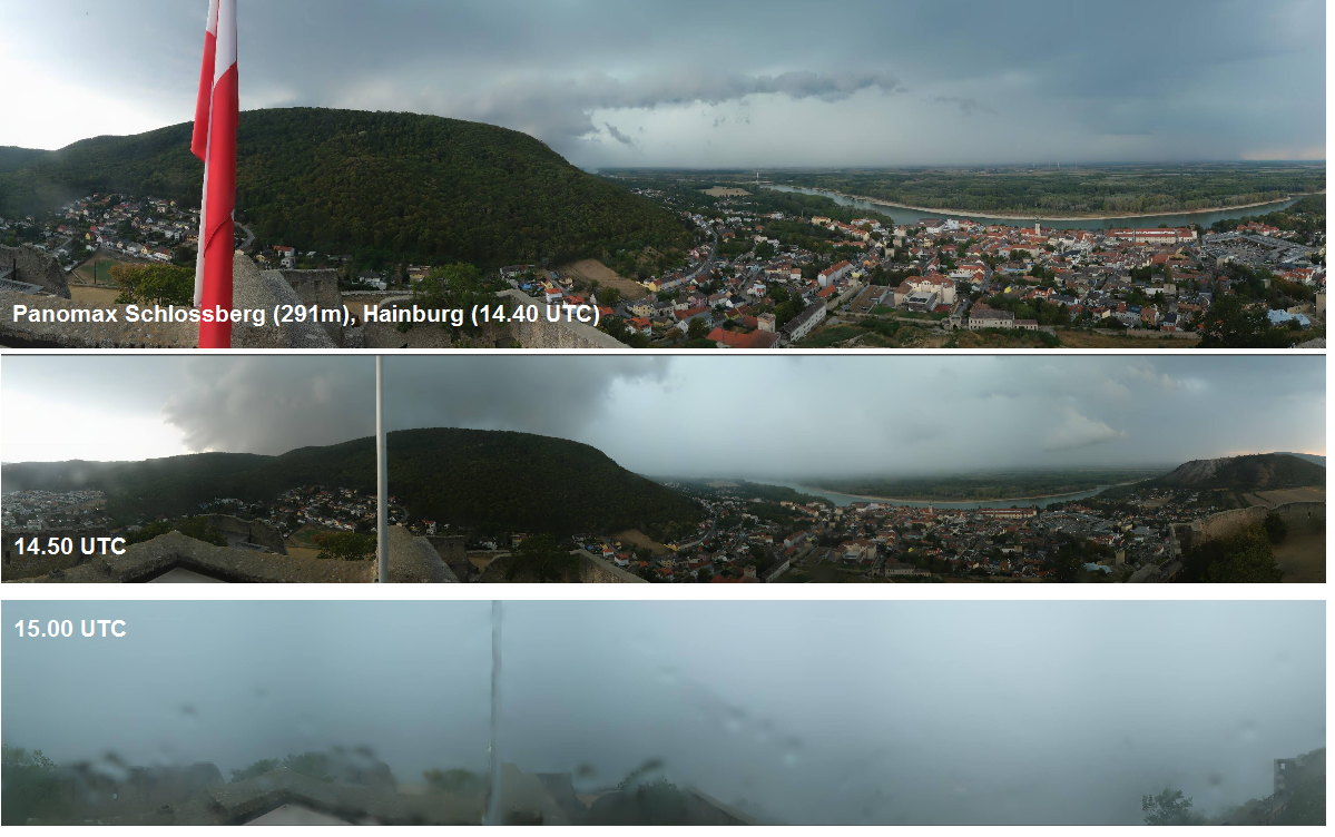
Schwechat Panomax (first storm)
Schwechat Panomax (second storm)
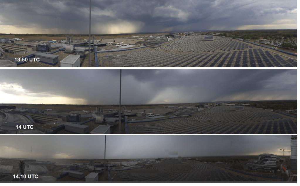
Airport Schwechat measured the highest rain rates (60mm/min) during the peak wind gust (71kt). Interestingly wind directions changed from westerly winds with the heaviest gusts to strong easterly winds at 14.30 UTC. I remember a quite similar course of events during the major hail event in Innsbruck in 2010 (case study), with a wet microburst with westerlies and then easterlies. This change of wind direction also points to a microburst event rather than a tornado event, with radial outflow.
Radar imagery
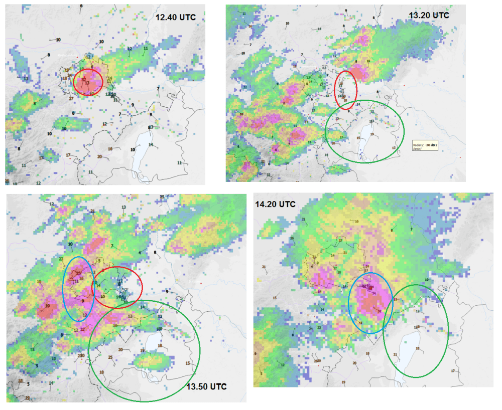
The first supercell storm hit (southern) Vienna city with heavy rain, 2-3cm hail and strong wind gusts (12.40 UTC).
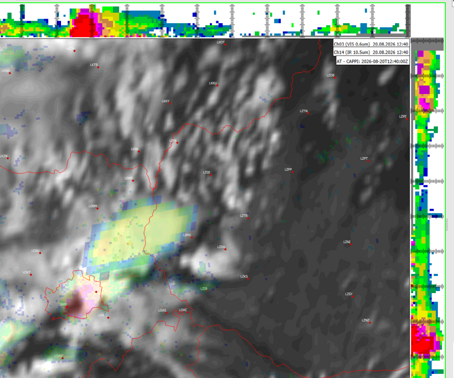
Separation of updraft and downdraft in the mature stage of the storm
Radar reflectivity and cloud top maximum have been decoupled during that phase, producing the majority of reflectivity in the lower part of the storm, while the anvil clouds already moved downstream. Normally, updraft/downdraft separation would indicate further strengthening of a mesocyclone circulation but in this case, no tilted updraft has been present according to cross-section radar images. As the maximum of 70 dBZ (100mm/h in VIL) occured, the anvil plume has already drifted downstream, with lowest cloud top temperatures a few minutes thereafter.
The storm became outflow dominant, undercutting its own inflow and dissipating while approaching the eastern border. While moving quickly eastward, the storm produced some northerly outflow gusts towards Vienna airport (13.20 UTC).
Storm dynamics became complex afterwards. Moderate E-SEly winds prevailed over Eastern Plains, modest NEly winds over SE Vienna and airport, and Wly winds increased over the eastern rim of the Alps due to exploding deep moist convection there (13.50 UTC). In other wirds, strongly convergent surface wind field in the area of interest. As the storm intensified over LOWW and south of it, strong NWly gusts occurred, creating intense LL convergence (14.20 UTC) further downstream.
The storm crossed Vienna with a textbook BWER (vault), indicating strong updrafts and possible large/intense hail growth.
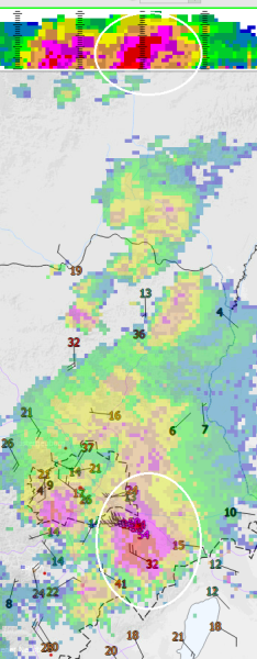
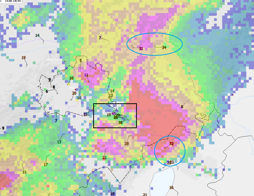
After leaving Vienna International airport, the storm started to grow in size and magnitude, becoming increasingly outflow dominant with maximum reflecivity (high precipitation load, hail). Outflow winds became radial, with strong easterly winds near Vienna.
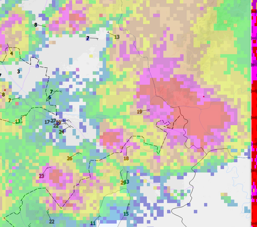
30 minutes later, the storm reached the Austrian border and again, we see easterly outflow gusts (Bad Deutsch-Altenburg) after strong SWly gusts before, as well as weak Nlies further southward.
Preliminary conclusions:
Strong southwesterly upper-level flow, strong helicity due to backing LL winds. Unstable air mass with > 1500 J/kg MUCAPE. Well-mixed boundary layer below 800hPa (inverted V profile). In general, supercell storms have been favored but high LCLs prevented rotation from reaching the surface.
Strong low-level convergence developed in early afternoon after the first (supercell) storms developed over the eastern rim of the Alps, creating a cold pool with westerlies. Easterly to southeasterly winds dominated over Eastern Plains (gradient wind). With the first storm passing just north of the airport, surface wind field became modified, with northerly outflow winds – adding to the convergental component. As the second round of storms moved in, LL convergence further increased and massive amounts of instability /helicity have been released.
Downdraft intensity has been so strong that a severe microburst occured downstream of Vienna airport, damaging buildings, trees, cars and agriculture. In LOWW, peak wind gusts occurred at the same time as maximum rain rates, so it’s probably safe to assume this happened also afterwards. The video footage in a car near Maria Ellend shows intense precipitation and hurricane-force winds. Due to the intense downdraft, the storm managed to produce a reverse outflow against the mean steering flow (SE-> NE), leading to initially strong NElies at the airport and sustained NElies well after the storm.
Remarks: I can’t provide a damage analysis here ruling out rotational winds. Moreover I do not have adequate doppler wind data to analyse. Neverthless still an impressive event.

